
Underground mapping plays a vital role in helping organisations safely plan excavation, maintenance, and development projects while reducing the risk of costly delays, accidents, or damage. However, traditional survey methods are often too slow and labour-intensive to meet the demands of today’s complex infrastructure projects.
LiDAR and advanced imaging technologies are now revolutionising subsurface data collection by delivering high-resolution, high-density spatial information for a more accurate and detailed view of underground conditions. In this post, Headlight AI explores how LiDAR and imaging technology are shaping the future of underground mapping, delivering faster, safer, and more reliable results across a wide range of projects.
The Evolution of Underground Mapping
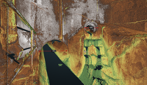
Underground mapping has evolved significantly over the years, moving from basic manual approaches to more sophisticated technological solutions. Early methods often relied on physical excavation, visual inspection, or outdated utility records, offering only a limited understanding of what lay beneath the surface. These techniques were slow, labour-intensive, and left considerable room for error, especially where records were incomplete or assets were buried deep.
While technologies like ground-penetrating radar (GPR) marked a step forward, many legacy systems still fall short in today’s complex environments. They often lack the precision and clarity needed to confidently detect and model underground assets, particularly in congested or layered subsurface conditions. As infrastructure projects grow more demanding, the limitations of traditional survey methods have paved the way for advanced solutions such as remotely operated LiDAR and imaging technologies, which offer the speed, accuracy, and detail required for modern underground mapping.
How LiDAR and Imaging Technology are Reshaping Underground Mapping
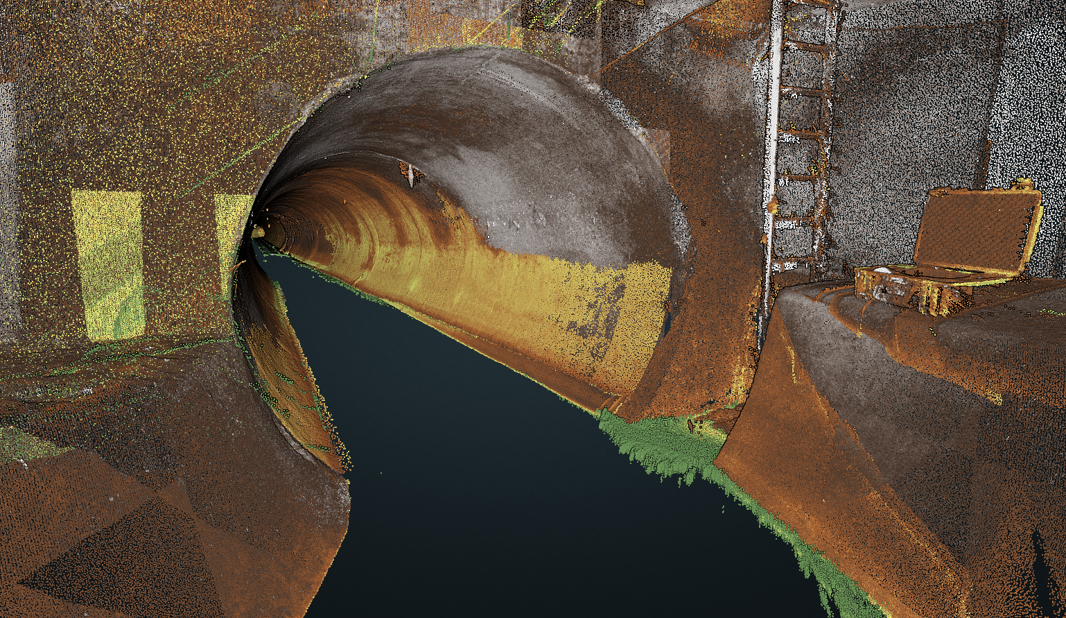
Modern mapping technologies have completely redefined how we view the subsurface in underground mapping projects. LiDAR (Light Detection and Ranging) uses laser pulses to measure distances with incredible accuracy, producing detailed 3D models of the environment. It’s highly effective for capturing the shape and elevation of underground spaces.
Advanced imaging systems, such as 360-degree cameras, photogrammetry, and thermal imaging, add further depth by providing visual context, material differentiation, and structural clarity. Together, these technologies collect high-density spatial data that is both rich and reliable, processed quickly with precision to reduce delays and eliminate guesswork. This integrated approach enhances project planning, supports better decision-making, and helps minimise risk in high-stakes or time-sensitive operations.

Applications of LiDAR and Imaging in Underground Projects
LiDAR and advanced imaging technologies can be applied across a wide range of underground mapping scenarios, offering detailed, high-accuracy data that supports safe and efficient project planning. Their versatility makes them invaluable tools for various industries where knowing exactly what lies beneath the surface is essential. Below are some important ways that LiDAR and imaging can be applied in underground projects:
- Utility Mapping – LiDAR and imaging technologies are used to accurately detect and map underground utilities such as sewers, storm drains, and in some instances water mains and aqueducts. They provide precise location data and visual clarity, helping prevent utility strikes and supporting safer, more effective infrastructure management.
- Infrastructure Development – Projects like tunnels, roads, and railways rely on accurate subsurface data from the outset. LiDAR captures terrain and voids in detail, while imaging supports analysis, enabling better planning, reducing risks, and helping prevent costly delays caused by unknown underground obstacles.
- Environmental Monitoring and Archaeology – In sensitive or protected sites, non-invasive tools like LiDAR and imaging offer accurate underground mapping from above ground, without disturbing important sites. These methods are ideal for ecological assessments and archaeological studies, providing detailed insights while helping preserve the integrity of the surrounding environment.
The Power of Telesto: Headlight AI’s Intelligent Mapping Solution
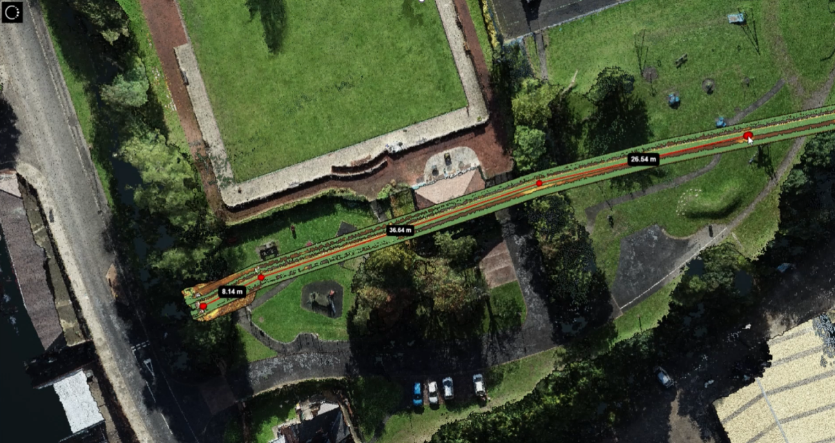
At Headlight AI, we specialise in creating intelligent underground mapping solutions that bring clarity, speed, and safety to subsurface exploration. Our flagship product, Telesto, is an advanced platform that integrates LiDAR and imaging technology into one compact, powerful system. Designed to overcome the common limitations of traditional surveys, Telesto enables users to collect, analyse, and visualise underground data accurately and efficiently.
It is transforming underground mapping by radically changing how data is captured and used, bringing new levels of insight and precision to projects of all sizes and complexities. Below, we look at some of the ways Telesto helps deliver faster, safer, and more reliable mapping across a wide range of applications:
Faster Project Delivery
Telesto is designed for rapid deployment, allowing teams to collect high-resolution data in a fraction of the time required by manual methods. Its seamless workflows and integrated data processing help streamline every stage of a project, ensuring decisions can be made quickly and with confidence, keeping projects on schedule and within budget.
Improved Safety on Site
With Telesto, you gain a clear and detailed picture of what lies beneath before any ground is broken. This minimises the risk of striking buried utilities or encountering unexpected hazards. By enhancing visibility and planning, Telesto helps protect both your team and the surrounding infrastructure throughout every stage of the project.
More Reliable Subsurface Models
Telesto also produces high-accuracy 3D models using high-density spatial data, giving engineers and planners a true-to-life representation of underground conditions. This accuracy means fewer surprises during excavation and construction, better alignment with design models, and improved collaboration across teams using the same trusted data source.

Contact Headlight AI for More Information
Telesto is setting a new standard for underground mapping, providing a fast and quantifiable method to collect and analyse subsurface data – transforming the way projects are planned and executed. If you’re looking to modernise your underground mapping approach and achieve better outcomes for your projects, Headlight AI is here to help.
Contact Headlight AI today to learn more about Telesto and how it can support your underground mapping projects with greater precision, speed, and confidence. Telesto is available to pre-order or hire, so you can start benefiting from its capabilities right away. Fill out our contact form, call us on 01273 121325, or email us at [email protected] to take the first step towards safer, faster, and more reliable underground mapping results.