A LiDAR & Imaging Solution for Underground Inspection & Mapping
Our award-winning, flagship product, primarily used to collect condition and location data across underground assets, especially for water and wastewater infrastructure.
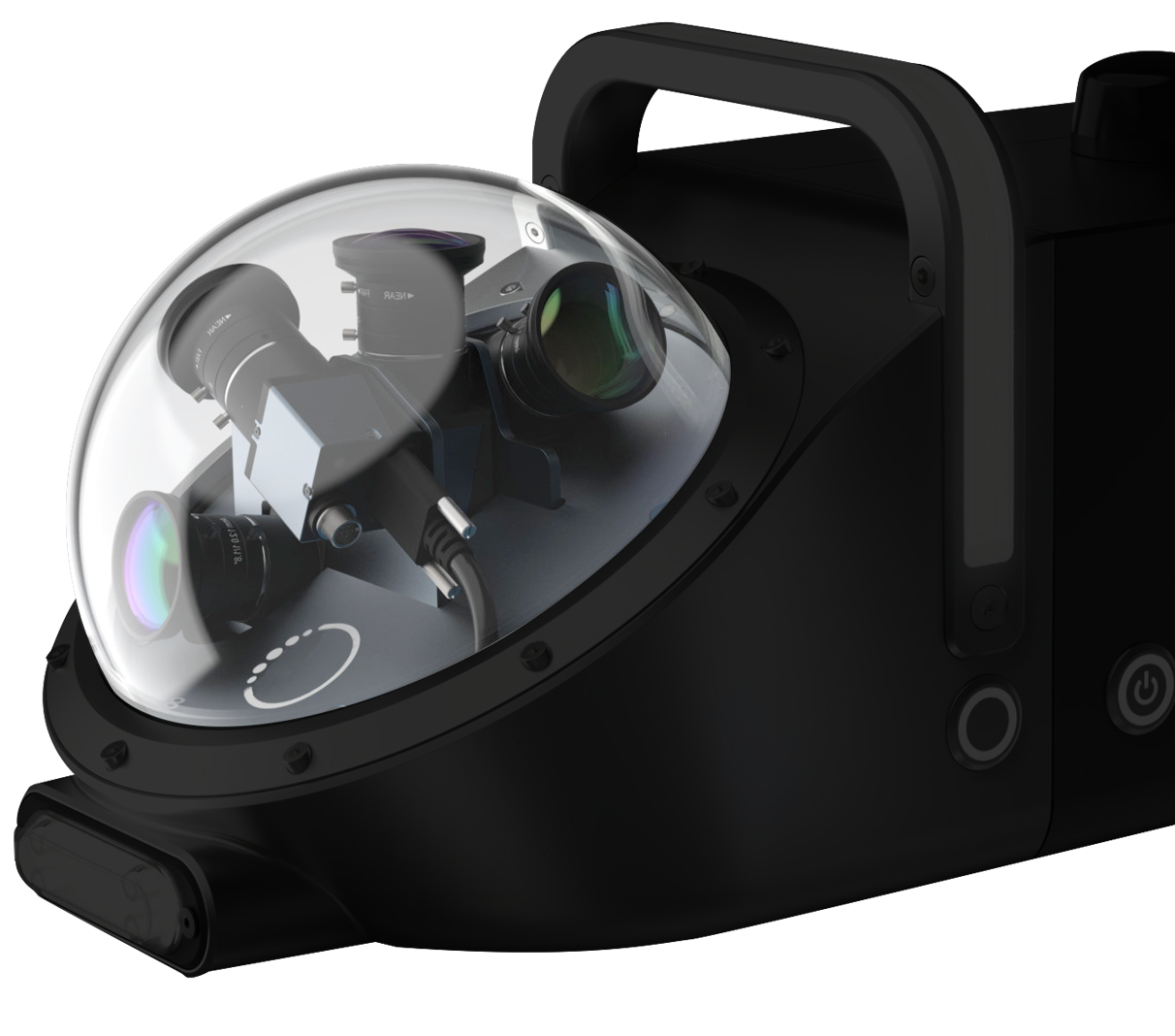
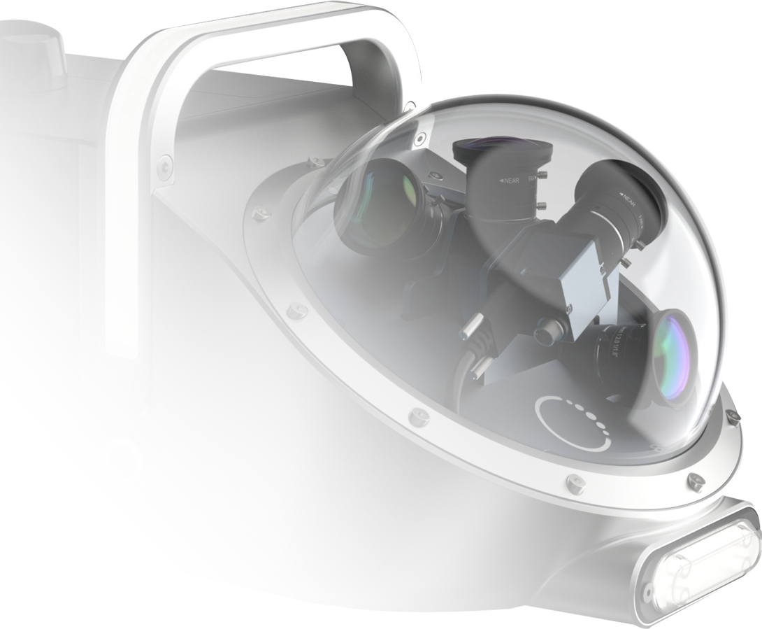
200° field of view cameras for detailed top and side images along with a forward facing camera for condition assessment videos.
360° spinning scanner continually captures data points at a rate of 30Hz using light detection and ranging (LiDAR).
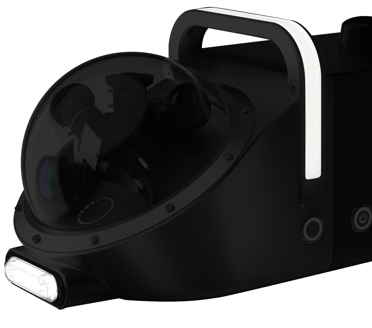
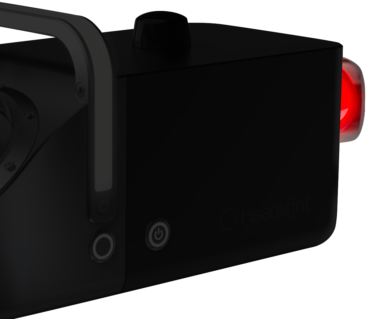
Front-facing light and a curved lighting bar that doubles as a carrying handle.
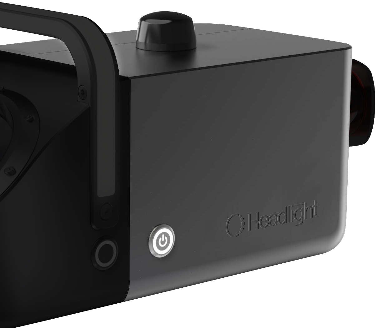
Watertight housing protects the internal components and in-built control software, providing motion tracking, 2TB of storage, and a secure wireless connection.

Powerful data. We’ve combined multi view CCTV with LiDAR allowing you to co-register data.
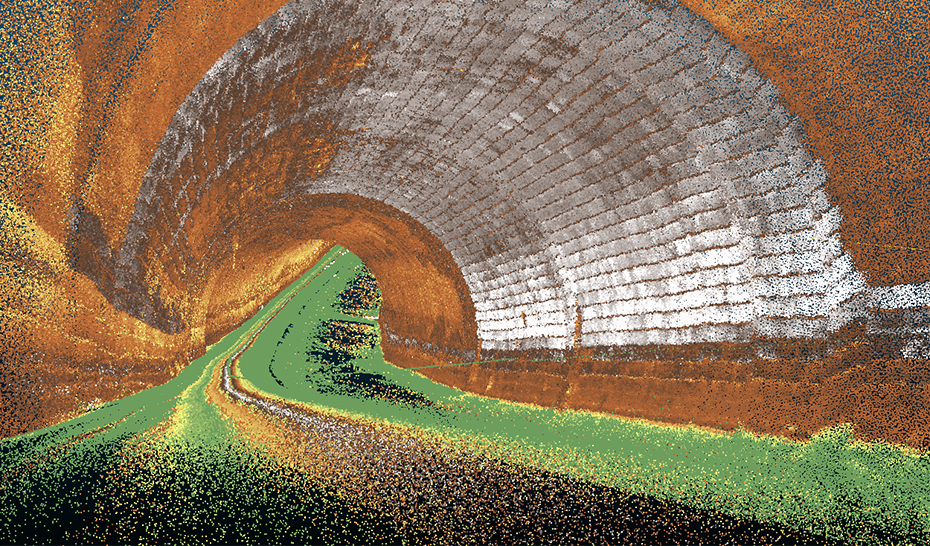
Multi sensor data is processed using Telesto™ software, resulting in 3D point clouds and high definition images and video files. All of which is accessible via the Telesto data platform via your web browser. This ensures you can always access your data, whether you are at the office, working from home, or out collecting new survey data.
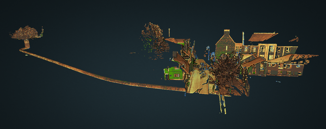
Start accurately mapping your assets and building 4D models (x, y, z and time) to track defects over time for predictive maintenance. Data can be analysed via our web-based platform where annotations and measurements can be added.
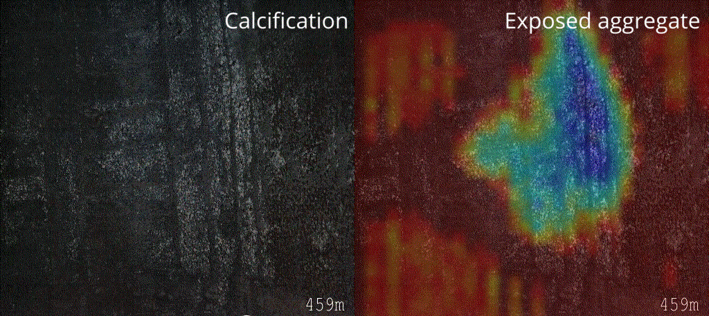
Telesto™ utilises novel AI technology to detect and locate defects and deformations from 2D & 3D data including calcification and exposed aggregate.

Telesto™ minimises person entry into the confined spaces of live assets (sewers, culverts, etc.) to enhance process safety.

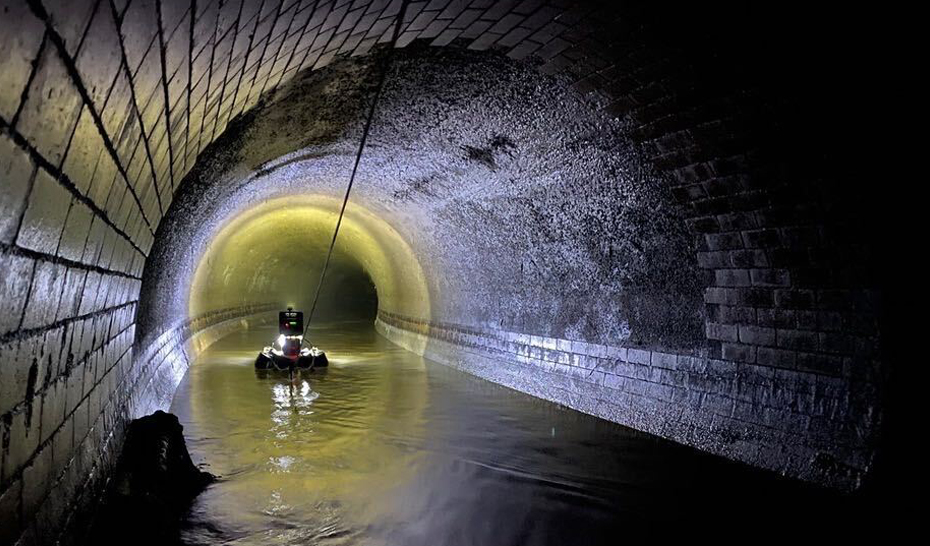
Telesto™ can be fitted to boat or crawler units for surveys of dry and flowing assets. Capture upto 2Km of multi-image and LiDAR survey data per day.

Telesto™'s secure Wi-Fi connectivity feature allows devices to connect seamlessly for data download & visualisaton.

Telesto™ uses artificial intelligence (AI) to identify patterns and features from 2D and 3D data, continuously improving its capabilities over time.

Telesto™ saves time on reporting by automatically drafting condition assessment reports using all the information collected and the AI analysis.

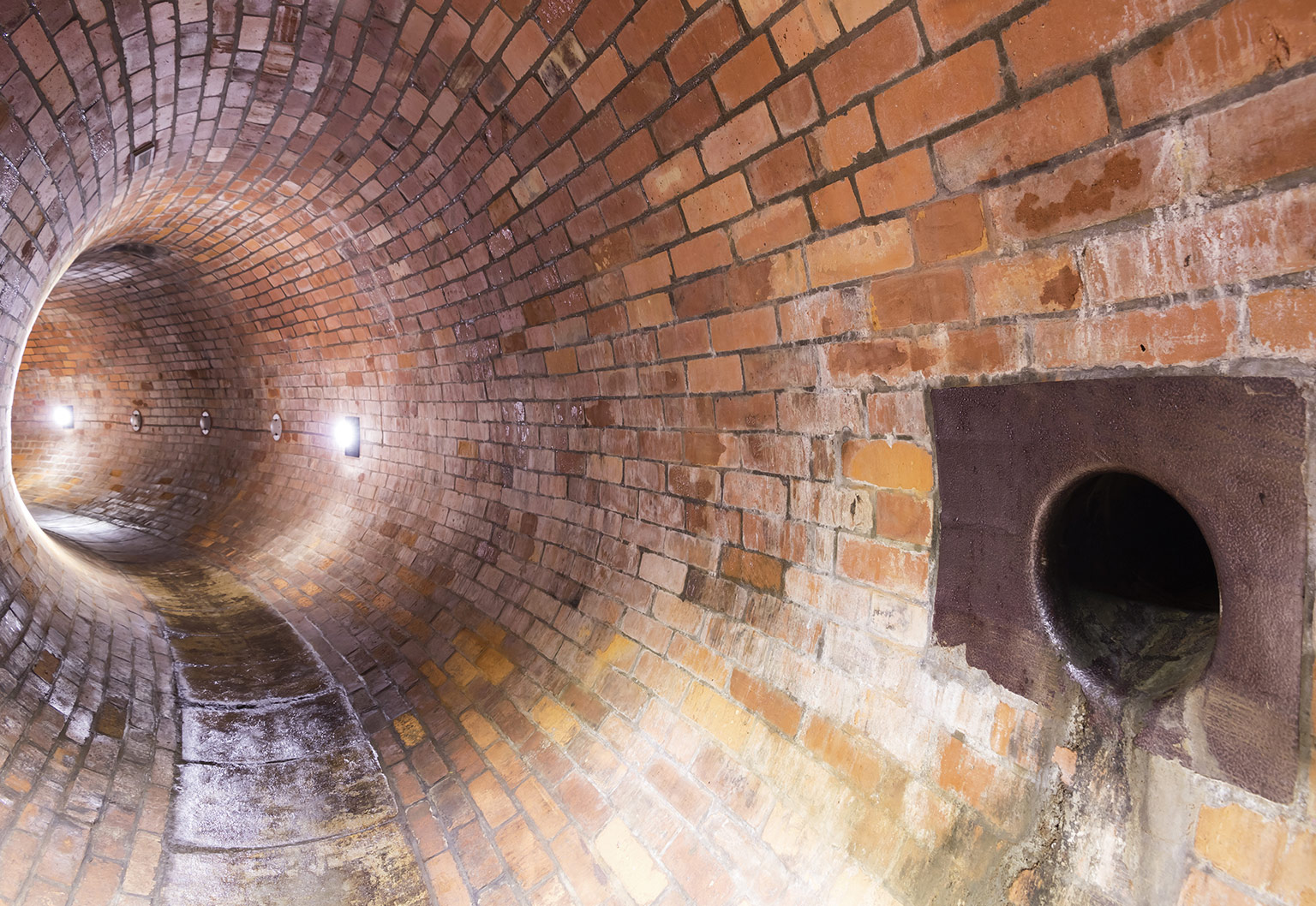
Water and wastewater infrastructure requires regular condition assessment, and in some cases there is a need to obtain geolocation information for both maintenance of utilities and for construction projects. This information is often not available, out-of-date, or requires collection via high risk and labour intensive processes. Telesto™ provides a new way to collect condition and geolocation data more safely and efficiently across large diameter (>600mm) water and wastewater assets.
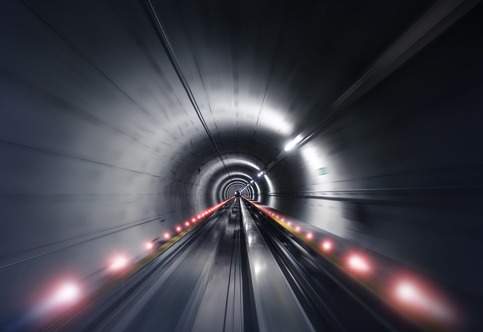
Rail and transport infrastructure (e.g. highways) consists of tunnels and other linear infrastructure that requires regular inspection. In some countries this infrastructure also pass over or is near to underground voids and abandoned mine workings, hence requires regular monitoring to assess risks. Through the Prometheus project we are developing new technologies to do so more safely and efficiently through robotics and AI.

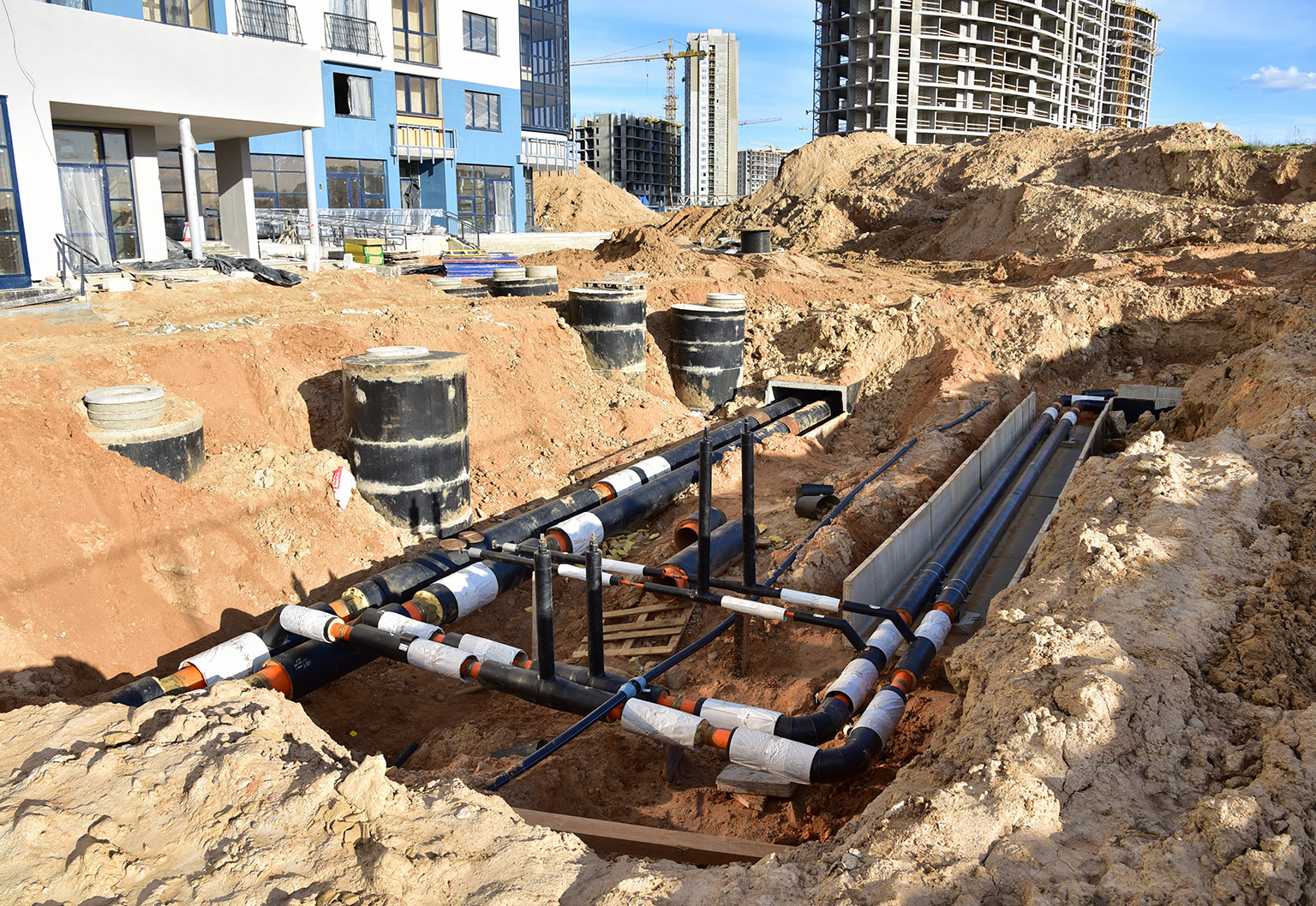
Construction and urban development is often delayed due to the need to investigate and accurately locate underground infrastructure; such as gas pipes, sewers, and cables. However, doing so is essential, especially when the construction involves piling and tunnelling work. Telesto™ provides a solution to companies looking to accurately locate the line and level of culverts, sewers, and tunnels in the design or build stage of a construction project.

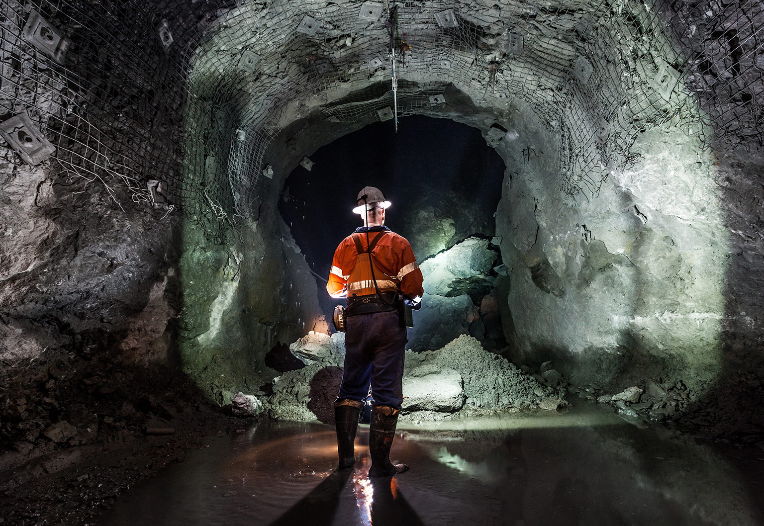
Underground mines present numerous hazards to workers and require regular surveying for health and safety. Geo-referenced 3D maps are also needed in the investigation of new mines, and for active, working mines, to ensure efficient operations and value. Surveying is also needed for estimating the costs of closing a mine. Through the Prometheus project we are developing new technologies to do so more safely and efficiently through robotics and AI.

There are numerous underground environments where people can readily become lost or trapped. There is a need for new technologies that can assist search and rescue teams in such circumstances. We’re developing technologies that can enable enhanced sensing and navigation in underground environments, which we seek to incorporate into solutions that can help search and rescue teams.

Across many offshore applications there are a variety of pressure vessels, containers and other confined spaces, that require regular inspection. This is mostly to assess the condition of such structures for health and safety, and to ensure they remain efficient from an operational perspective. Through the Chimera project we are developing new technologies to do so more safely and efficiently through robotics and AI.